An official website of the United States government
Skip to main content
BaltimoreMiss KatieGalveston IslandYellowfinN 6003Unloader No. 2York 1636Alaskan HawkN 4001BrunswickEssayonsStuyvesantArrow PointDS 6Frederick PaupE.W. EllefsenRockbridgeNewmarketR.B. WeeksHurleyLong PointOhioMS 16ColumbiaWF 9AtlanticCrowPronckaiWheelerVirtuousVirginianNjordBorinquenOyster BayKatie JohnVinton CrosbyDodge IslandN 6002N 6001ChesapeakeCaptain FrankAllison CrosbyFullertonPelicanTexasM-1702SandpiperCrosby DredgerBlack HawkPadre IslandBaltimoreMiss KatieGalveston IslandYellowfinN 6003Unloader No. 2York 1636Alaskan HawkN 4001BrunswickEssayonsStuyvesantArrow PointDS 6Frederick PaupE.W. EllefsenRockbridgeNewmarketR.B. WeeksHurleyLong PointOhioMS 16ColumbiaWF 9AtlanticCrowPronckaiWheelerVirtuousVirginianNjordBorinquenOyster BayKatie JohnVinton CrosbyDodge IslandN 6002N 6001ChesapeakeCaptain FrankAllison CrosbyFullertonPelicanTexasM-1702SandpiperCrosby DredgerBlack HawkPadre Island

Benefits

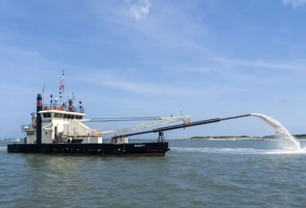
Dredging Quality Management (DQM) is the U.S. Army Corps of Engineers' standardized system for monitoring, documenting, and improving dredging operations across the nation’s waterways. By combining precise positioning data, automated production reporting, and transparent quality controls, DQM provides real-time visibility into dredging performance—supporting safer navigation, smarter contract management, and responsible environmental stewardship.

From coastal harbors to inland channels, DQM ensures that every cubic yard is measured accurately, every operation is traceable, and every stakeholder—from Corps districts to industry partners—has access to reliable, defensible data. The result is better decision-making, improved efficiency, enhanced accountability, and greater confidence in maintaining America’s critical navigation infrastructure.

Benefits

Operational Efficiency & Continuous Oversight

DQM provides continuous, 24/7 monitoring of dredging and disposal activities across the nation’s waterways. Through standardized onboard instrumentation and automated reporting, the program delivers near-real-time visibility into operations; reducing paperwork, improving accuracy, and letting USACE and contractors focus on performance and results.

Nationwide Standardization

The National DQM Program establishes a consistent data standard across all USACE Districts. Because specifications and instrumentation are uniform nationwide, contractors can move vessels between projects without changing monitoring systems. This consistency simplifies contracting, improves coordination, and ensures dredging data are reliable and comparable from project to project.

Transparency & Accountability

DQM creates a detailed, objective digital record of where and when dredging takes place. These standardized production reports provide a shared factual baseline for the Government and industry partners alike. By documenting operations clearly and consistently, DQM strengthens accountability, reduces misunderstandings, and supports fair, efficient resolution of contract questions.

Environmental Stewardship & Compliance

Responsible dredging requires careful coordination with environmental regulations and resource agencies. DQM supports compliance by documenting operational activity in relation to permit conditions and sensitive areas. Integrated tools enable rapid responses to environmental or public concerns, reinforcing USACE’s commitment to protecting natural resources while maintaining navigation infrastructure.

Data-Driven Planning & Better Estimates

Years of consistent, high-quality operational data strengthen government estimates and long-term planning. Historical production metrics improve budgeting accuracy, contract development, and future project design. By grounding decisions in verified performance data, DQM helps ensure efficient use of public funds and continued reliability of America’s navigation system.